Data Science

Bachelor of Arts Major & Minor
As technology progresses, humanity has gathered increasingly larger and more complicated data sets about our lives and world. Hidden within all of that data are the answers to our most challenging problems. To find those solutions, we need talented data scientists who can program algorithms, give insightful analysis, provide predictive models, and reveal explanations. If you enjoy discovering patterns and connections that lead to resolution and clarity, data science—one of the most lucratively paid fields in the job market—may be for you.
Data Science is useful across disciplines such as Business, Biology, Psychology, Sociology, and Environmental Science. You’ll learn the mathematics, statistics, and computer science skills required to effectively extract information from large data sets, analyze results, and communicate your findings.
Why Data Science at Warren Wilson?
- A Sustainable Focus: You’ll focus on applying Data Science to challenging problems in areas such as environmental sustainability and social justice.
- Create Real Change: Many of the data sets you will decode can solve issues and create real change in our region.
- Real-World Work Experience: Internships with community partners such as NOAA or the National Climatic Data Center and work on our campus Information Technology or Data Science crews will give you an impressive resumé before you graduate.

Every student will complete community-engaged coursework, an internship, and original research as part of their major
A sample of our partnerships:
- Math Counts
- Hickory Science Olympiad
- Bounty and Soul
- Inclusive Development International
See how Data Science students put our education into action
Internship
Every Data Science major will complete an internship as part of their major. The region around Asheville is particularly well known for being a hub of climate data, and Warren Wilson has strong working relationships with organizations such as NOAA (National Oceanic and Atmospheric Administration) and the National Climatic Data Center.
Community Engagement
In Linear Algebra, you will work in partnership with the Buncombe County Chapter MATHCOUNTS Competition and the local Science Olympiad to facilitate youth engagement in math and science. You will also have the opportunity to work with after school programs such as M.A.N.O.S or Community Nights at Owen Middle School to support local students.
Work
You can work on any crew as a student, but many Data Science majors choose to be on crews such as:
- ITS
- Data Science
Research
Data Science students recently won a state award for their work with local nonprofit Bounty and Soul to improve food access. In a project funded by a South Big Data Hub grant, they used machine learning to analyze health and social vulnerability data to create maps to help the organization prioritize locations for healthy food distribution and nutritional counseling.
Popular Courses
Machine Learning
Using programming languages such as R and Python, you’ll master machine learning techniques such as clustering, classification, and regression. You’ll become fluent in extracting information from large data sets, building and interpreting statistical models that can be used for predictions, and creating effective visualizations and data summaries.
Advanced Geographic Information Systems (GIS)
In this course, you’ll further your understanding of how to use geographic information science to help people and the planet. You’ll learn about spatial analysis procedures on raster and vector data, database management, topology, model design, 3D modeling, open source GIS, web mapping, and project management. This course culminates in you designing and conducting a research project to solve a real-world problem for our local community.
Environmental & Social Advocacy with Data
You’ll learn how to use Data Science to help address problems in environmental sustainability and social justice through case studies. This course prepares you to succeed in your research. By the end, you will choose your Capstone topic and find robust data sets to analyze in depth.
David Abernathy, Ph.D.
Research Interests
- Geographic Information Systems
- Environment-society relations
- Geography of Panama
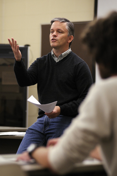
“Warren Wilson students crave a challenge. I am continually amazed at the enthusiasm with which our students throw themselves into an endeavor, whether it be a physically exhausting service trip or an intellectually stimulating research question. Wilson students tend to say “bring it.””
Holly Rosson, Ph.D.
Research Interests
- Mathematical Modeling and Data Science with applications to environmental sustainability and social justice.
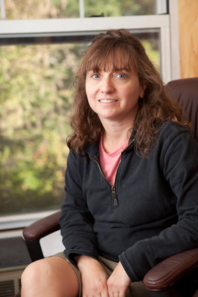
“I love the diverse interests of students, faculty, and staff at Warren Wilson.”
Christopher Potvin, Ph.D.
Research Interests
- Topological Data Analysis
- Algebraic Topology
- Hypergraphs

“Working with students is my biggest passion. I think my motto as a long time summer camp counselor and director sums up my teaching philosophy pretty well: Camp is for the campers!”

“The collaborative relationship with professors, the student crew system where we took ownership of campus problems, and the freedom to experiment in both work and education – these all mirror the principles I now thrive on in startup environments. It’s not just what we learned, but how we learned it that prepared me for a career in technology and AI.”
Michael Fink
(he/him)
Senior AI Software Engineer at Six Robotics in Norway
Major, Minor, Concentration, Crews
- Biology Department Crew
- Mathematics Department Crew

“The willingness to roll up my sleeves and step into a situation of uncertainty with a growth mindset was the most important lesson. I believe in entropy, everything changes… those who can embrace change beyond their comfort zones can succeed in ways that will surprise even themselves.”
Phillip Weber
(he/him)
Agile Coach and Technical Program Manager
Major, Minor, Concentration, Crews
- Pool Crew
Where Our Data Science Graduates Go
- NASA
- Vips/Mobile Pay
- Nuix
- Six Robotics
- University of Colorado Denver
- University of Colorado Boulder
- Georgia Tech
- University of British Columbia
